Summit day: 2.5 miles and 3,100 feet (8hrs. up and 4 down)
After two days of waiting for good weather inside the tent we got an opportunity to go for the summit! It was quite the surprise too. The weather seemed to always be changing. The base camp manager relayed the weather forecast each night at 8pm over the radio. You could pick it up on one of the little walk-talkie radios. It had worked pretty good the entire trip until high camp. The first night we tried to get the forecast we were told you had to walk to the ridge outside of camp to pick it up. Well, it came in spotty at best. Then, the next night I thought I would humor us while playing cards and I turned on the radio. Low and behold it came in loud and clear! She said the next day was going to be partly cloudy with summit winds less than 10mph! That night the low was -25F and the next day's high was -15F.
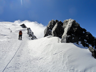
From camp you traverse a 1,000 ft. section called the Autobon up to Denali Pass. More climbing falls have occurred here than anywhere else on the mountain. They happen mainly on the way down when climbers are tired. The park service has buried metal pickets along the traverse marked with bamboo wands to encourage climbers to rope up and clip into the running belays (which we did).
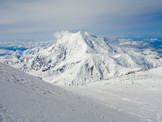
Looking back at Mt. Foraker. We have read that if you see a cloud cap (lenticular clouds) form on Mt. Foraker that means high winds are coming, take cover. It looked great all day for us! :)
Up and over the pass, headed for Archdeacon's Tower and the "football field."
The rocks were so beautiful!
For eight hours the pace was....step, breath, step, breath, step, breath a few times, step, breath....
At the top of this ridge, we stopped for our second break. I took my water bottle out of my backpack and set it down for just a moment while I grabbed something else, and then looked down to see it roll away, never to been seen again. Bummer....that left us short a whole liter of water for the day (and the rest of the trip). I guess I am lucky that it didn't happen much earlier in the trip or that it wasn't my whole backpack like the unfortunate soul that lost his life a couple of weeks earlier over that very thing.
Going across the football field! 19,500 ft! It was only a quarter mile long plateau but it took forever to cross. You still couldn't speed up on the level terrain because of the lack of oxygen. It is said that because of the latitude of this mountain (63 degree N) the oxygen levels (the summit is 42% of what is at sea level) are equivalent to those of Himalayan Mountains at 23,000 feet.
A close-up of the line of climbers ascending to the summit ridge ahead of us.
What views!
On the summit ridge! 230 feet from the top of North America!
The summit behind us. It was so much work to get here, 7+ hours already, that when I looked up and saw the ridgeline and summit, and really knew that I was going to make it, I broke down and started balling. The tears would not stop streaming down my face. I couldn't believe it! The next few hours were over-whelming emotionally. Hundreds of peoples faces and smiles were flying through my head as I walked those last couple hundred feet. Andrew and I could literally feel the love, the thoughts and prayers, the cheers from people all across the country. It was incredible!
The photo below is a zoomed in, cropped version of the photo above....our friends Jonas and Bard were standing on the summit!
That summit ridge was too awesome!
See the climbers on the ridge in this picture?
It was too perfect....as we were approaching the summit all the guided groups were headed down.
A couple of photos Jonas took of us approaching the summit!
Yahooooo! :)


Lots of traffic on the way up, it seems.
ReplyDeleteSome of that snow looked like an avalanche waiting to happen.